
Lake Oswego Postal Coverage
Official City material identifies two postal zones serving Lake Oswego: 97034 and 97035. The evidence supports postal examples, not a definitive neighborhood-boundary map or named-station table. That limit matters. Use the ZIP below as a starting point, then verify the actual deliverable address through USPS instead of assuming that every address in a familiar area receives the same code.
| ZIP | Areas Covered | Post Office | Notes |
|---|---|---|---|
| 97034 | Lake Oswego city-center example, including City Hall | USPS exact-address verification | A City Hall postal example confirms the code; no authoritative neighborhood boundary map was located. |
| 97035 | Lake Oswego Westlake-area example | USPS exact-address verification | A county election-site notice uses a Westlake address with this code; it remains delivery geography, not a city line. |
Neither entry is a resident list. Postal labels can reach addresses across municipal or county lines, and a Lake Oswego mailing label does not by itself select a recorder, court, elections office, or assessment jurisdiction.
Lake Oswego Postal Boundaries
Myth: a ZIP is a city boundary. ZIPs are USPS delivery geography. They are not municipal boundaries, county boundaries, parcel identifiers, or a directory of people. Lake Oswego is primarily in Clackamas County, but a searcher should confirm the parcel and city location rather than rely on a postal-city label.
This distinction affects every records request. The City holds records for addresses within city limits, while deeds, property ownership, assessment/tax records, surveys, and septic records follow county or state custody. A city-looking delivery address outside the City’s record jurisdiction may need a county route instead.
Postal geography first, jurisdiction second. Verify delivery information with USPS, then identify the parcel and the custodian that holds the requested record.
Lake Oswego Postal Permit Route
A verified ZIP can help keep an address search tidy, but Lake Oswego permit research still depends on the exact street number and normalized street name. The City directs historical permit searchers to set the Start Date to 1900, enter the whole street number with the first three letters of the street name, omit directional prefixes, and select Lake Oswego as the city.
The Lake Oswego E-Permitting instructions route the public to the Oregon Accela Building search. A permit or inspection file may document a project, applicant, contractor, or approval date. It does not establish that a person currently lives at the address. For an older or missing file, make a targeted city request that gives the address, date range, project type, and record category.
Verify Lake Oswego Delivery Codes
The official USPS ZIP Code Lookup is the best route for a delivery question. Enter the complete address as USPS recognizes it, including the street number, street name, directional term when used in the address, and unit when applicable. The returned ZIP or ZIP+4 is tied to that precise deliverable address, not a broad neighborhood guess.
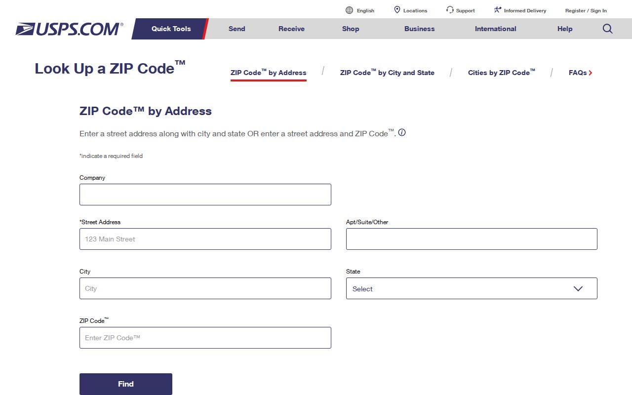
Save the result as a postal check. If a county map or city form uses a different address style, normalize the street name before repeating the property search. A changed label does not establish a different parcel or resident connection.
Lake Oswego Postal Property Search
Clackamas County’s AscendWeb is address first. Its ZIP/Postal Code box is an optional qualifier, not a way to browse all people or all properties in a ZIP. Enter a street address or, when known, the account number. Add the verified ZIP only to narrow a search where an address may be ambiguous.
| AscendWeb field | Type | Required | ZIP search role |
|---|---|---|---|
| Account Number / Alternate Map Account | Text | Yes in account mode | Eight-digit county account route; bypasses a postal search when known. |
| Street Address | Text | Yes in address mode | The required key for the address path; the county suggests a % wildcard between number and street name. |
| City | Text | No | Optional property-search qualifier. |
| State/Province | Text | No | Optional property-search qualifier. |
| ZIP/Postal Code | Text | No | Optional verified qualifier; no ZIP-only person or owner browse is announced. |
The AscendWeb property search currently exposes taxpayer or owner, mailing-address, value, and sales fields on individual accounts. A property owner or tax contact is not automatically a current resident, and a mailing field can belong to a trustee, agent, or other recipient.
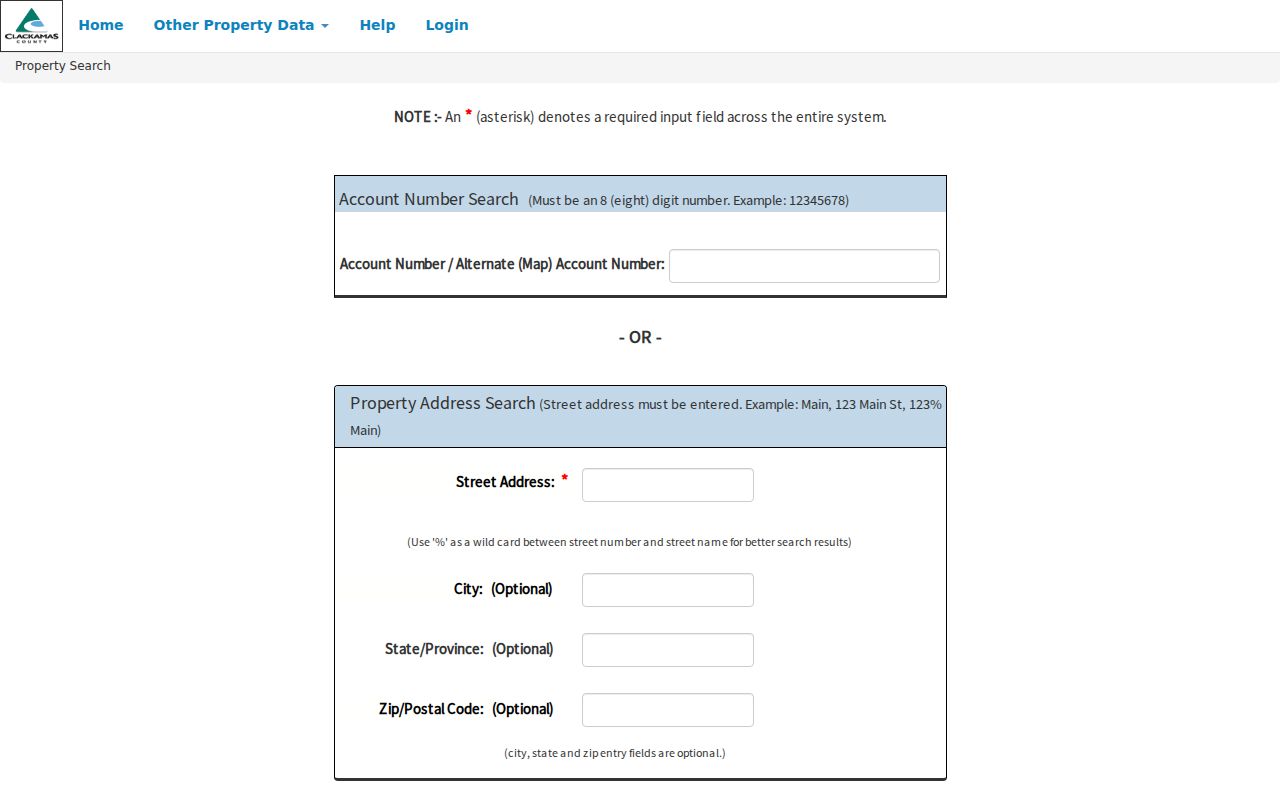
Use the account reference from a successful search when moving to a map, a city permit file, or a Recording request. It adds a county identifier that the postal code alone cannot supply.
Lake Oswego Postal Map Context
CMap is the county map companion to AscendWeb. It accepts address, city, intersection, tax-lot, or parcel searches and helps place a verified address within its visible parcel context. It does not publish owner names online, and its displayed boundaries are not survey quality.
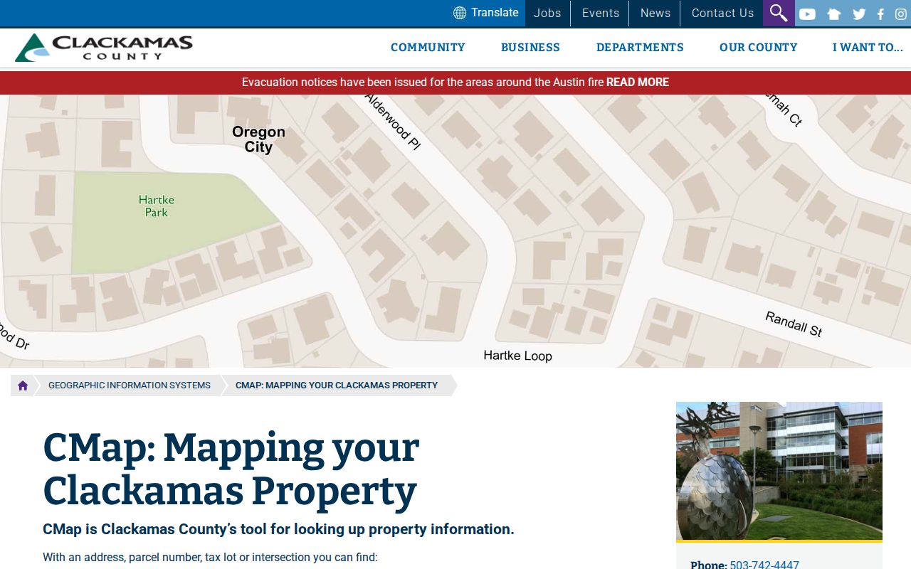
Use the map to check the property path after a USPS result, not to redraw the ZIP boundary. CMap’s city option organizes county-map searching and is not a postal-boundary declaration.
Find Lake Oswego Records by ZIP
A ZIP-guided search stays precise when it keeps the address at the center. The sequence below narrows property research without making a delivery code do more than it can.
- Verify the full delivery address and ZIP with USPS.
- Search the full street address in CMap to identify the parcel, tax lot, or account route.
- Open AscendWeb with the street address and add the ZIP as an optional qualifier if needed.
- Record whether the result is a situs address, an owner/taxpayer field, or a mailing field before comparing it to another source.
- For a deed or recorded instrument, use the account, legal description, party name, or date through County Recording rather than a ZIP alone.
For an official voter-list question, Oregon uses a request process rather than a public ZIP browser. The Secretary of State voter-list request describes statewide and less-than-statewide access; county officials handle local hardcopy or non-electronic formats. Protected information is excluded.
Lake Oswego Address Roles
The same property can carry several address-related labels. They should not be treated as interchangeable when searching records.
- ZIP code
- A USPS delivery-routing code assigned to a specific address. It does not define the city, county, parcel, or a resident group.
- ZIP+4
- An added delivery detail returned for a particular address or delivery point. It is more precise for mail routing, not a property identifier.
- Situs address
- The physical property location used in assessment records. It can be the key to a parcel account.
- Mailing address
- The correspondence address associated with an account. It may be different from the situs and does not prove occupancy.
- Legal description
- The lot, plat, subdivision, or related instrument language used to link land in recorded documents, especially when street labels vary.
- Carrier route
- A USPS delivery grouping used for mail operations. It is not a city limit or a public household list.
These distinctions avoid false matches. A ZIP filter can help select an address result, while a legal description is the stronger bridge to a recorded land instrument.
Lake Oswego Postal Zones and City Limits
The crucial local fact is simple: 97034 and 97035 serve Lake Oswego addresses, but the codes do not define the City of Lake Oswego or Clackamas County. City public-record requests apply to existing City records for addresses within city limits. For a property, tax, deed, survey, or county-service question outside that jurisdiction, contact the county or state custodian instead.
The Lake Oswego public-records request route is useful for a specific city permit, code, council, or departmental file. Give the exact street number, date range, and record category. It is an additional channel to county assessment and recording, not a substitute for them.
Lake Oswego Postal History Limits
For historical research, begin with the street and period place name rather than a modern ZIP boundary. Older materials can be filed under Oswego, Lake Grove, or Lake Oswego because the 1960 Lake Grove annexation changed the city name. Maps and directories from their own period can explain an address label that a modern postal lookup cannot.
The City’s 1927 Sanborn maps and the Lake Oswego Public Library’s local-history resources are better historical location tools than a current delivery code. The research did not locate an authoritative ZIP realignment history, so no split, realignment, station boundary, or neighborhood coverage should be assumed.
Once the full address is known, use the Lake Oswego street directory for the address-by-address parcel, deed, permit, and historical-directory workflow.
Lake Oswego ZIP Directory Limits
A delivery code helps verify mail delivery and sharpen an address query. It does not identify every resident in a postal area, prove that a person occupies a property, or determine which jurisdiction holds a record. Property accounts, recorded instruments, voter records, permits, and directories each have separate public boundaries and dates.
USPS can resolve a delivery question, CMap can locate a county parcel, and AscendWeb can expose a property-account record. Their agreement may support an address trail, but their disagreement is a reason to pause and check the original inputs. Do not fill a gap with an unsupported claim about residency, ownership, or city jurisdiction.
Use a specific, lawful research purpose and verify important information with the office that holds the record. Do not use postal, property, or voter information to stalk, harass, or harm anyone.